INTRODUCING
BOOKINGS ON WIKICAMPS
Talyuberlup Peak Trailhead
 Public Dump Point
Description
Talyuberlup
Class 5
Height: 783m
Distance: 2.6km return
Allow three hours. You'll cross increasingly steep terrain through varied vegetation to a rocky crag at the summit where you can take in extensive views of the Stirling and Porongurup ranges.
Find this site and more on WikiCamps
Take the ultimate camping companion on your next trip, with these great features:
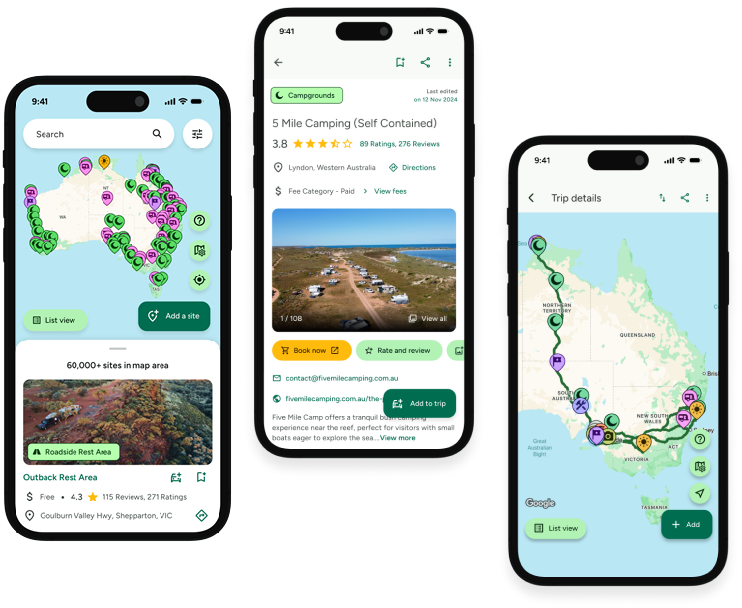
![]() Explore more than 60,000 sites across Australia with detailed site information at your fingertips
Explore more than 60,000 sites across Australia with detailed site information at your fingertips
![]() Stay in the know with exclusive, insightful reviews from fellow travellers
Stay in the know with exclusive, insightful reviews from fellow travellers
![]() Map journeys, plan your route, and gauge your fuel spend with Trip Planner
Map journeys, plan your route, and gauge your fuel spend with Trip Planner
![]() No signal? No worries! Use offline mode to travel anywhere with WikiCamps
No signal? No worries! Use offline mode to travel anywhere with WikiCamps
![]() Add sites to your collections, search with intuitive filters, and so much more...
Add sites to your collections, search with intuitive filters, and so much more...
Get WikiCamps now!
Download WikiCamps from the App Store on your device.

