INTRODUCING
BOOKINGS ON WIKICAMPS
Mt Pololona Trailhead & John Eyre Memorial
 Campground
Description
The Mount Allalone Trail starts from here
Grade 4
1.6km each way
Allow 2h return
Mt Allalone is well named for it being a fine example of an isolated hill or inselberg (a German name meaning
'island mountain'). The hill is shaped in puddingstone or conglomerate with rounded stones set in a matrix of finer material. The conglomerate is between 1700 and 1600 million years old and is derived from sedimentary rocks which were breached by volcanic events more than 1590 million years ago and deposited on or around the volcanic material. This rock is quite different from the rhyolite hills comprising the Gawler Ranges.
Standing 348 metres above sea level, Mt Allalone is the hill Edward John Eyre climbed on the 22nd September 1839 whilst exploring lands on Eyre Peninsula. From the top, extensive views to the south over generally low level country (now predominately farmland) can be seen. To the north however, the view is obstructed by the impressive expanse of the Gawler Ranges.
Find this site and more on WikiCamps
Take the ultimate camping companion on your next trip, with these great features:
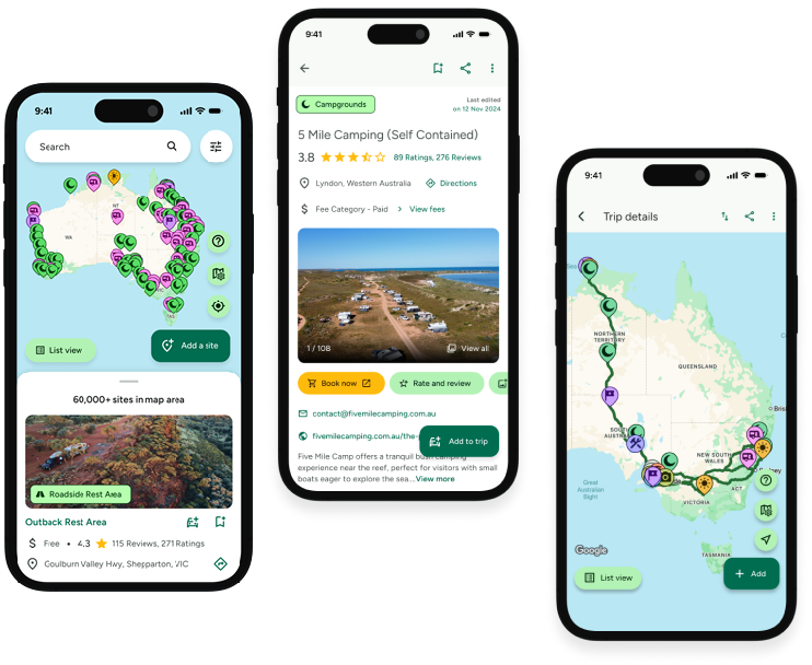
![]() Explore more than 60,000 sites across Australia with detailed site information at your fingertips
Explore more than 60,000 sites across Australia with detailed site information at your fingertips
![]() Stay in the know with exclusive, insightful reviews from fellow travellers
Stay in the know with exclusive, insightful reviews from fellow travellers
![]() Map journeys, plan your route, and gauge your fuel spend with Trip Planner
Map journeys, plan your route, and gauge your fuel spend with Trip Planner
![]() No signal? No worries! Use offline mode to travel anywhere with WikiCamps
No signal? No worries! Use offline mode to travel anywhere with WikiCamps
![]() Add sites to your collections, search with intuitive filters, and so much more...
Add sites to your collections, search with intuitive filters, and so much more...
Get WikiCamps now!
Download WikiCamps from the App Store on your device.

